


#29 of my 2021 52 Hike Challenge
Trail/Park: Magnetic Rock Trail, Superior National Forest
This hike took place on the traditional territory of Anishinabewaki ᐊᓂᔑᓈᐯᐗᑭ and Očhéthi Šakówiŋ. To learn more about the tribes and these lands, please follow the links provided.
Restaurant Recommendation: Poplar Haus
Trash Collected: 0.2 pounds


While we were planning our annual North Shore trip, I’d decided to make a stop at the map and guide books section of my REI store for a little supplement to my Superior Hiking Trail Guidebook and maps. John and I had discussed driving up the Gunflint Trail to check out a few favorite places a friend of his had recommended. Knowing my trusty copy of the Guide to the Superior Hiking Trail by the SHT Association wouldn’t capture potential hikes along the Gunflint, I decided to grab a copy of Andrew Slade’s Hiking the North Shore and a couple of Boundary Waters maps for the area we were heading. I never like to rely only on the AllTrails app, especially when I know my cell service is likely to be spotty.
I’d taken some time to look over options and after our Carlton Peak hike, I’d suggested we check out the Magnetic Rock Trail. The trial is relatively flat, about three miles round trip and would be near a restaurant a friend had recommended. Knowing the trail would be easier than Carlton Peak, John readily agreed. We got moving mid-morning, arriving at the trailhead ready for a relaxing hike to be followed by a late lunch or early dinner.


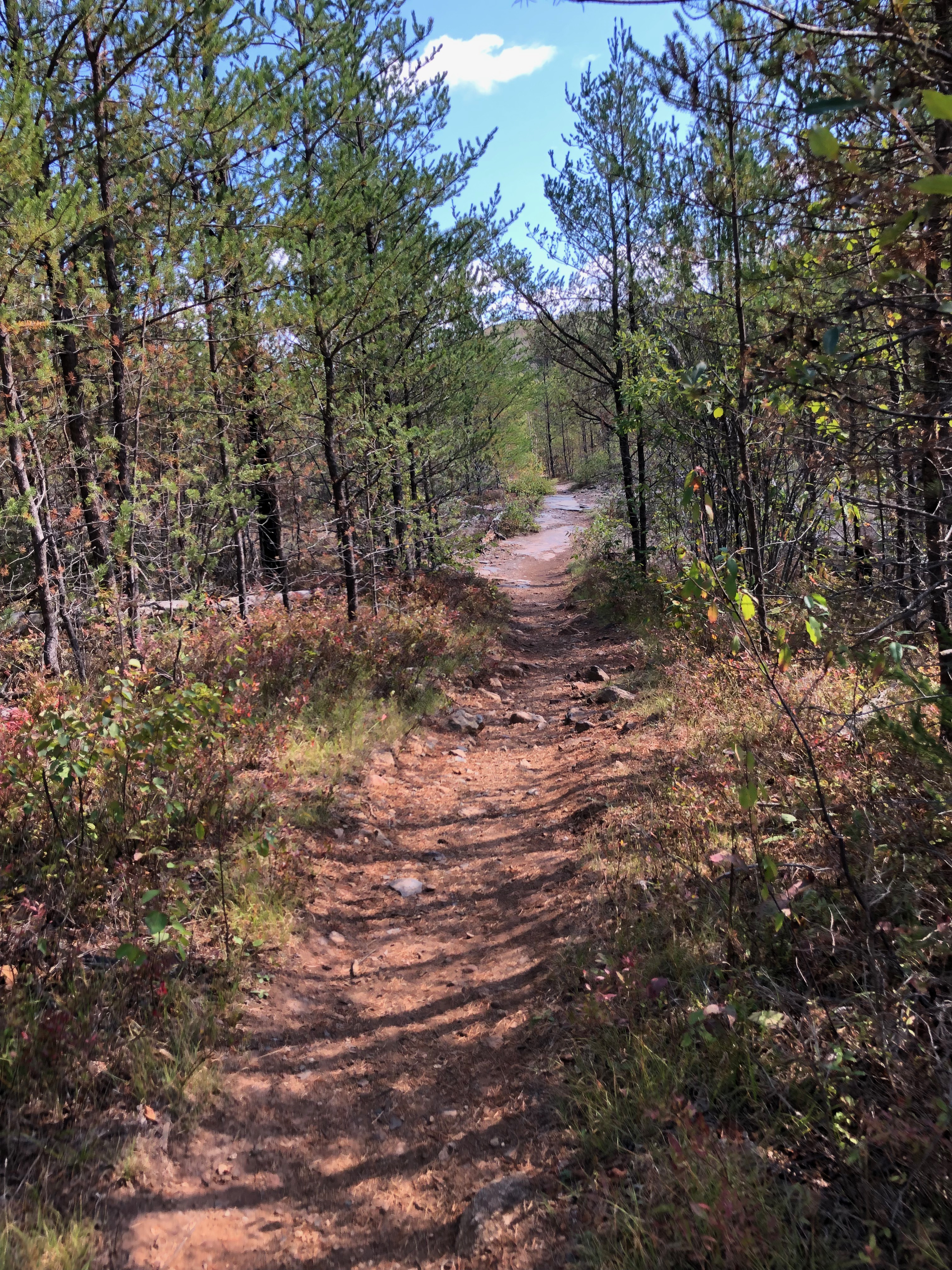
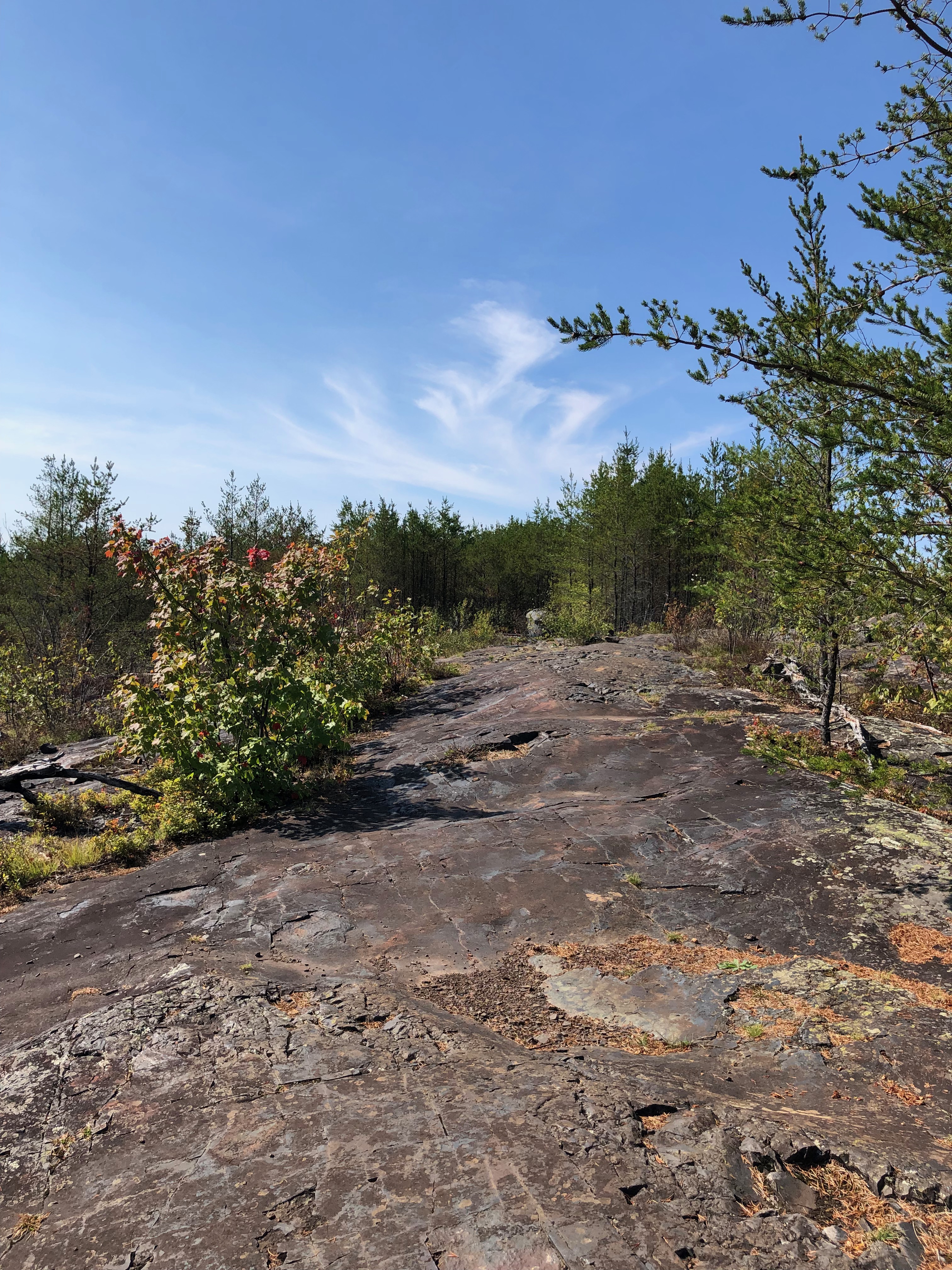
The day was beautiful. Bright sun, a crisp cool breeze surrounded us. The trail follows a small pond before turning to cross bedrock. Past disturbances to the area, including the 1999 blowdown, a 2002 prescribed burn and the 2007 Ham Lake wildfire have dramatically changed the landscape surrounding the trail. What was once pine forest is slowly returning, but the openness from those events are evident. It was also very obvious the lack of rain this part of the state has received this year. Plants which would normally thrive, even on the rocky terrain, were stunted and dry.
As we slowed to check out the lake, I noticed a small snake attempting to make its way across a gap in some rocks. Our approach caught the snake off guard and in changing its path it fell into the water and disappeared. A few minutes later it resurfaced further along between some rocks. Entering the rocky section, I again fully expected John would want to turn back, but to my surprise, the landscape had him intrigued enough to keep going.


Just like the previous day, we took a slow roll approach to our hike. The trail itself is a deep ruddy brown because of the iron ore which has been mined in the area for decades. The trail continues across the bedrock marked occasionally with cairns, then into a small stand of young pine. Views of a few smaller lakes in the distance dotted between the trees. Along the way we passed by folks coming back from Magnetic Rock.
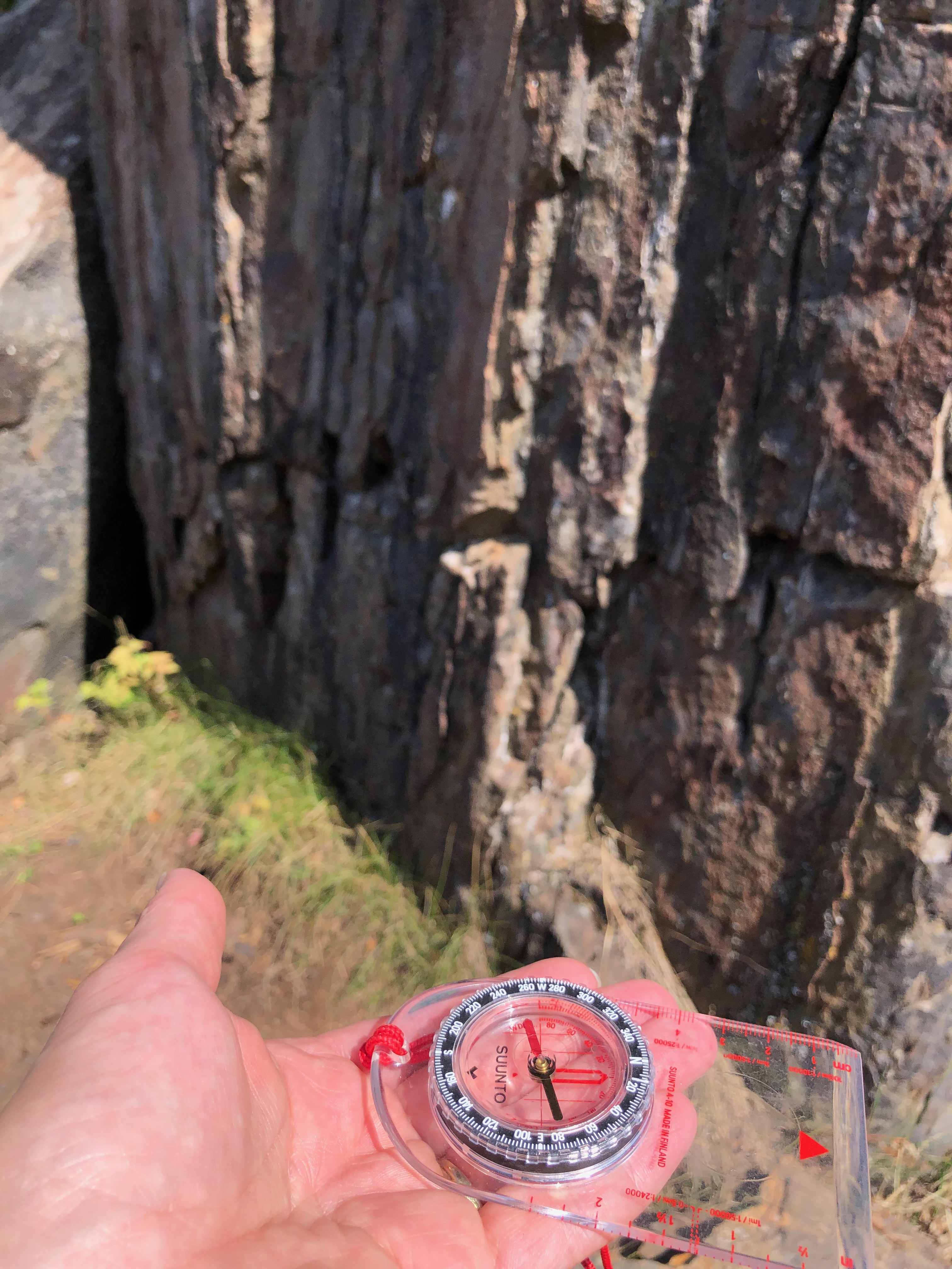


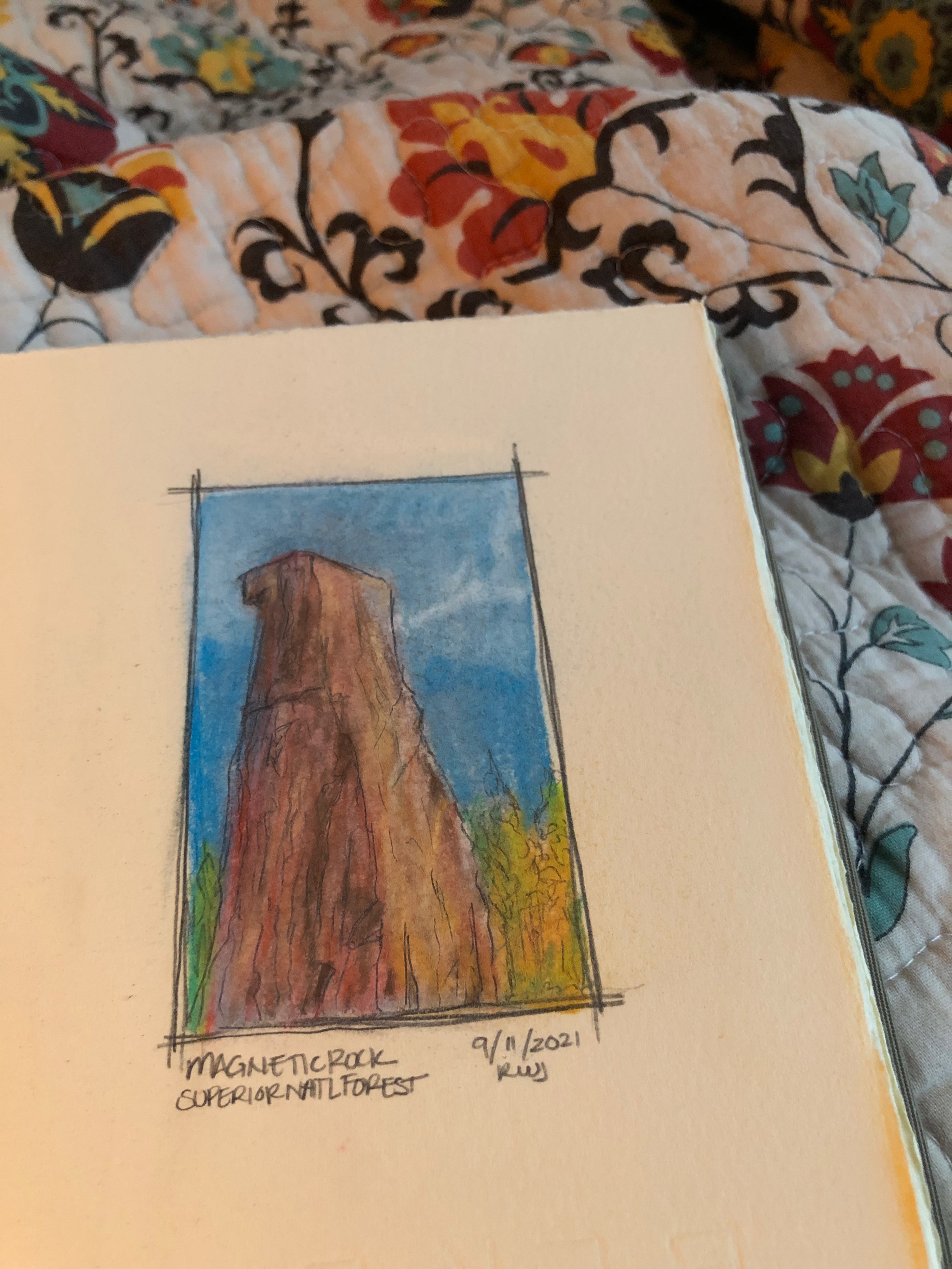
A little over an hour from our start, our slow roll brought us in view of Magnetic Rock. The 25 foot tall monolith stands out distinctly from its surroundings. We’d followed another small group for the last few yards. We gave them space to look around while I sought view from a side trail. More people showed up so we followed another side trail to a quiet spot where we took a break and chatted for awhile about all we’d seen on our way. It was interesting to watch as I pulled out my compass to see the rock did indeed have a pull on the needle.
I was smitten with the landscape. Knowing this spot is the western terminus of the Border Route Trail (BRT) fired up my interest in learning more about the trail. Perhaps this would be one of my future backpacking adventures?
The crowd briefly thinned so we headed to the rock so I could take more photos. As I finished up, I heard someone call out my name. Turning toward the voice, I was pleasantly surprised to see Melissa who I’d taken my Wilderness & Remote First Aid (WRFA) course with earlier this summer. We chatted for a bit about the summer – my finishing my goal of hiking all the Minnesota State Parks, her work as a guide in the BWCA being cut short due to fires and COVID. It was a wonderful happenstance we both appreciated.
John and I turned to head back to the car, while I told him more about how I’d met Melissa, the randomness of seeing her here and we continued to marvel at the landscape. Not far from Magnetic Rock I realized I’d set my water bottle down and left without it. We had another along, but the one I’d left had sentimental value so I turned back. A few minutes later I neared the rock, only to have one in Melissa’s group come up to me with the water bottle. They explained they’d watched me set it down, but had only just found it. They went on to say they would have tracked me down to return it. After all, Melissa and I are connected through Paul Kautz, (AKA CPR Dude, Hiking Dude and lotsa other Dudes) our WRFA instructor! Laughing and grateful, I turned back again toward the car.

All the way back to the car, John kept remarking how different this trail had been from what he’d anticipated. He delighted in the trail, the views and the day. For me I felt an immense sense of gratitude that we’d shared this day. Nearing the trailhead, I stopped to use the latrine which is located just off trail. It’s an open air seat with just enough cover to be discrete. While it might sound strange, I’ve only had a few other latrine views quite as beautiful. I hope that someday I’ll be back to take in the view again on my way to or from the BRT.

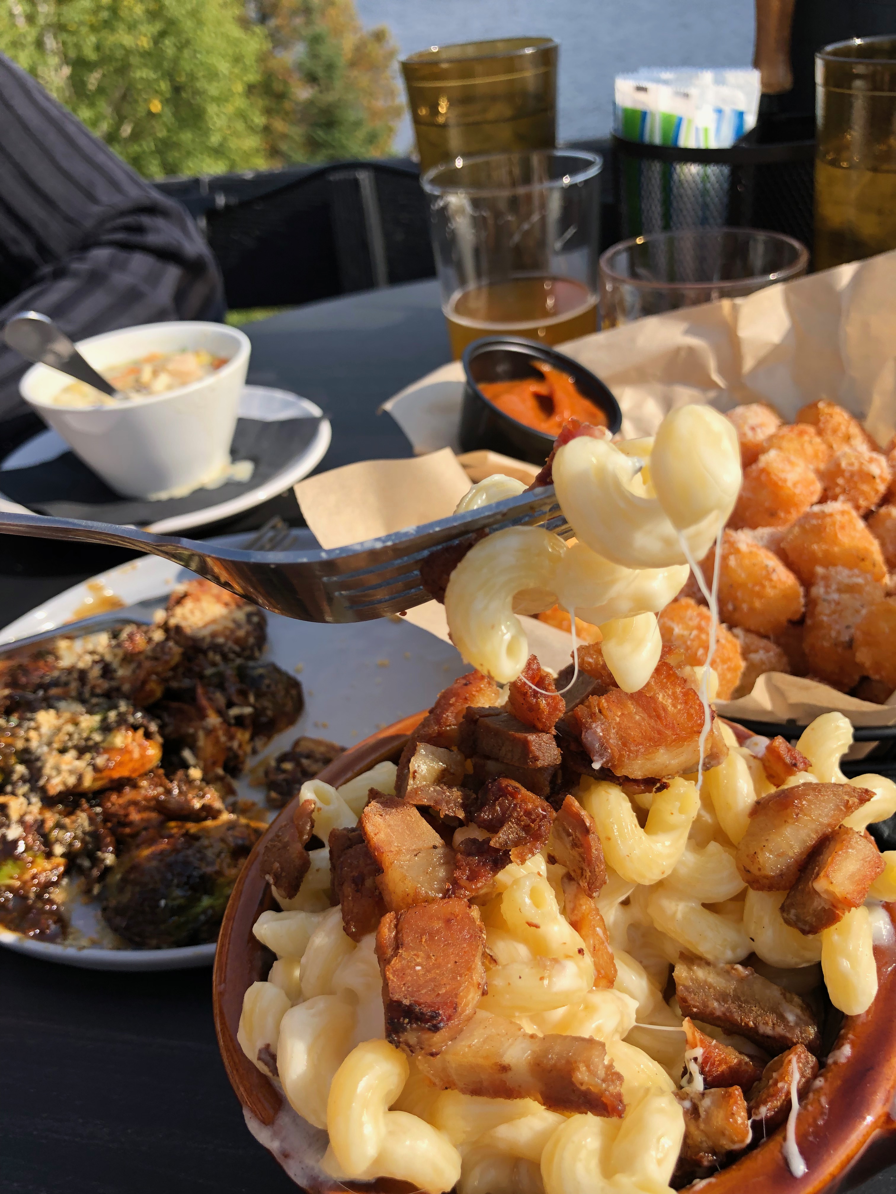
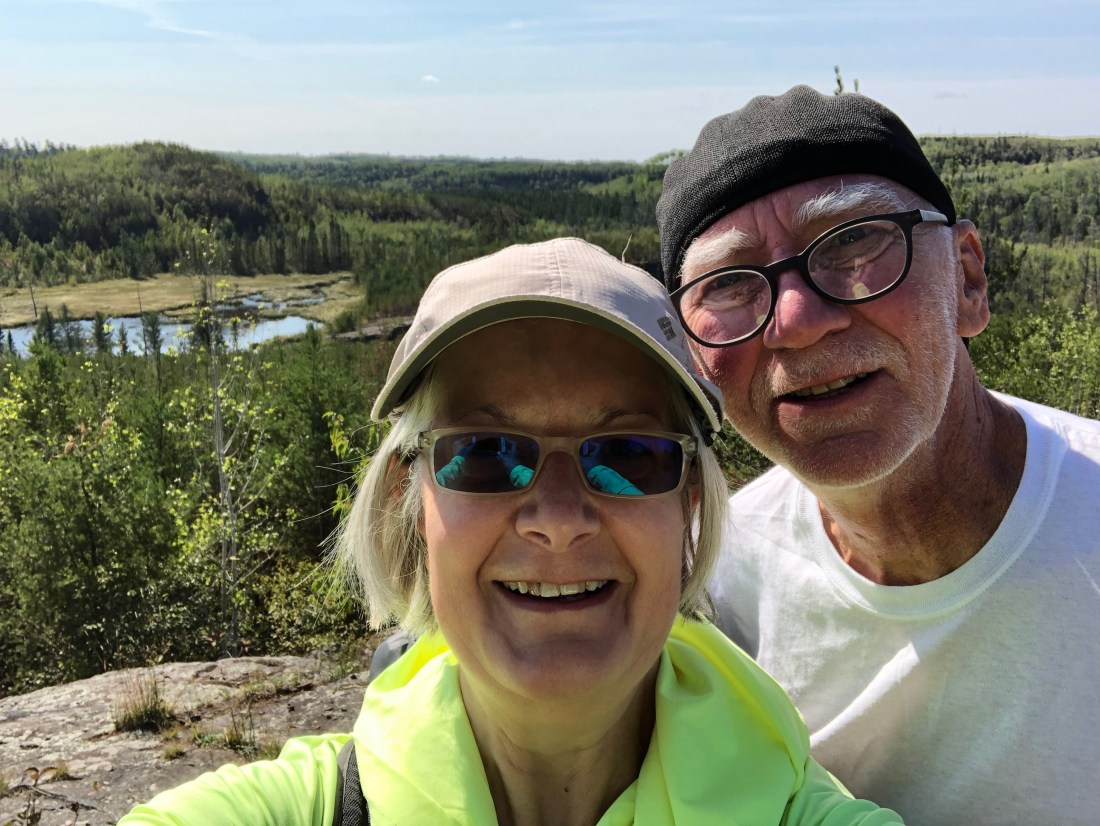
Back at the car, Melissa’s group had caught up with us. Melissa snapped a quick photo of us to share with Paul and off we went on our mission to get a late lunch at Poplar Haus. The restaurant had been recommended by a good friend. He was spot on. We sampled a few things from the menu accompanied by local beer and a solid old fashioned on the deck overlooking Poplar Lake. John was enamored with the area, much to my delight. Who knows? Maybe I can get him to go a bit further with me into the BWCA for a hike. Time will tell.
Next Post Preview: Some rain and an SHT spur trail make for a challenging hike with an unexpected twist.
GEAR: Merrell Women’s Siren 3 Mid Waterproof, REI Co-op XeroDry GTX Jacket, REI Co-op 650 Down Jacket, REI Co-op Rainier Full Zip Rain Pant, Marmot Kompressor Pack, SPOT GEN3 Satellite GPS Messenger, Kula Cloth, Leki Women’s Micro Vario Cor-Tec TA trekking poles. Want to know more about my gear selections? Head on over to Gear & Gadgets or check out my posts titled “Gear in Review”.


Support the work of
Ruth’s Blue Marble
If you like what you’ve found here, please take a minute and share with someone you think will enjoy it too. Your shares help me know what content is valuable and help support the organizations and companies I mention or link to in my posts.
Make A Donation
Make a one-time donation to support the Ruth’s Blue Marble blog.
Make a monthly donation to support the Ruth’s Blue Marble blog.
Make a yearly donation to support the Ruth’s Blue Marble blog.
Choose an amount ($5 – a virtual coffee; $15 – a virtual lunch; $25 – just because)
Or enter a custom amount that feels right to you.
Your contribution to bring this content to life is appreciated.
Your contribution to bring this content to life is appreciated.
Your contribution to bring this content to life is appreciated.
Copyright Ruth Wikoff-Jones, ruthsbluemarble.com | No Use Permitted Without Prior Permission
http://classic.avantlink.com/affiliate_app_confirm.php?mode=js&authResponse=74b3d6af58ba1cc3b5d7572f0a7bfc4c5bb7e65d