
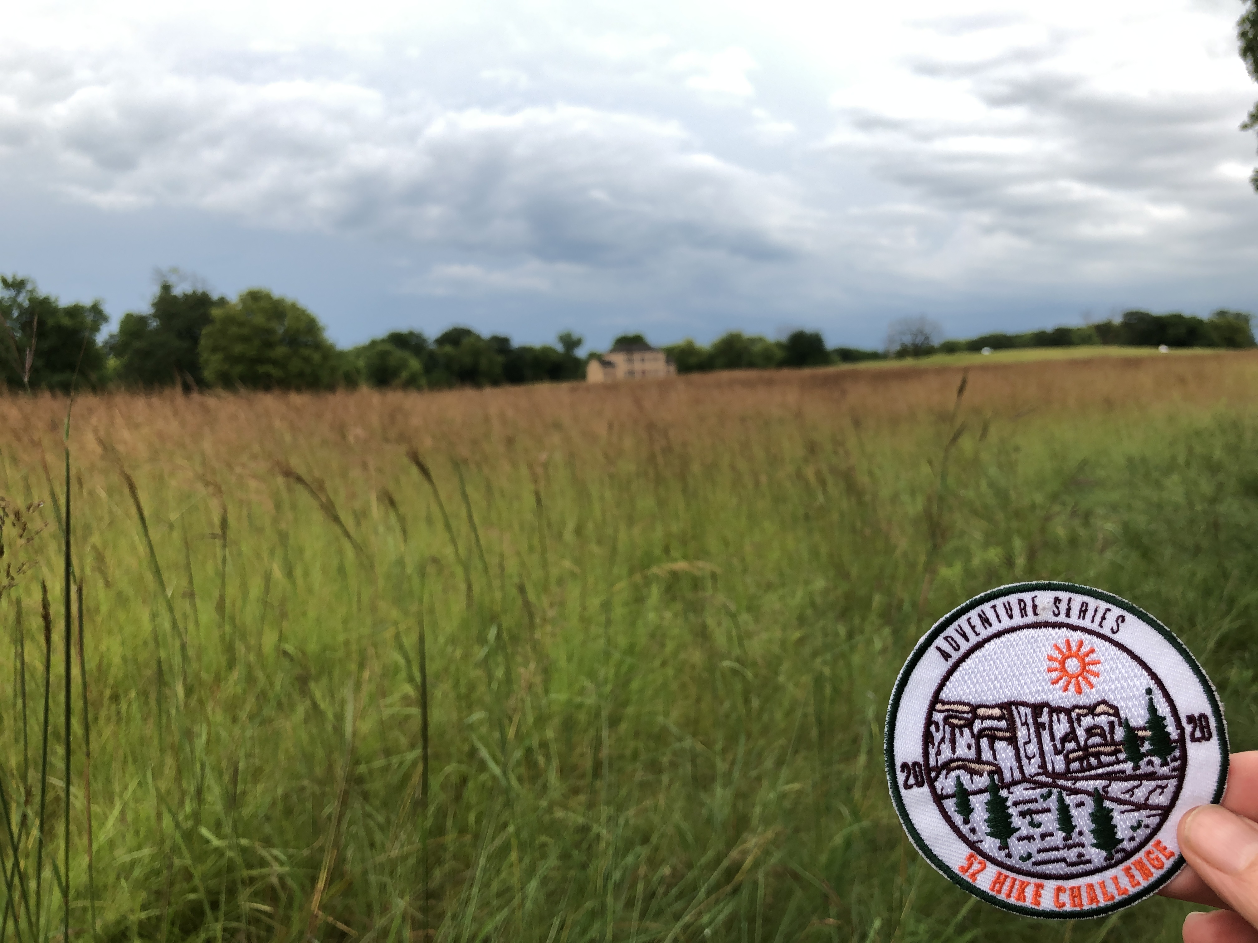
#35 and #36 hikes of my 52 Hike Challenge
Trails/Parks: Upper Sioux Agency State Park and Camden State Park
I want to acknowledge these hikes took place on the traditional territory of Yankton, Yanktonai, Očeti Šakówiŋ, and Wahpekute.
Trash Collected: 0.6 pounds

Upper Sioux Agency State Park
#35hike of my 52 Hike Challenge
Located about eight miles from Granite Falls, Upper Sioux Agency State Park is located between the Minnesota River and Yellow Medicine River. It’s a large park with a variety of trials for hikers and horse riders. The park’s history is tied closely with the Sioux and the U.S. Dakota War. The history is not pretty and often told from the perspective of the settlers rather than the tribes which were moved from their native lands to various locations in Minnesota where many eventually died of famine and exposure.
Getting there required navigating a rather long detour. I also knew this park would require access passing through tribal lands with minimal resources so my ability to stay completely solo was especially important. Most tribal land have seen high incidences of COVID with limited healthcare resources. This was a disappointment because I was hoping to dive deeper into the history of the site and see if this park might have a more balanced perspective on the U.S. Dakota War to share with visitors. Talking with park staff would have been especially interesting.
In checking the weather after the morning’s excitement, I had learned I’d have the chance for more rain so I navigated through the construction detour and found the entrance to the part of the park where the Hiking Club Trail is located.


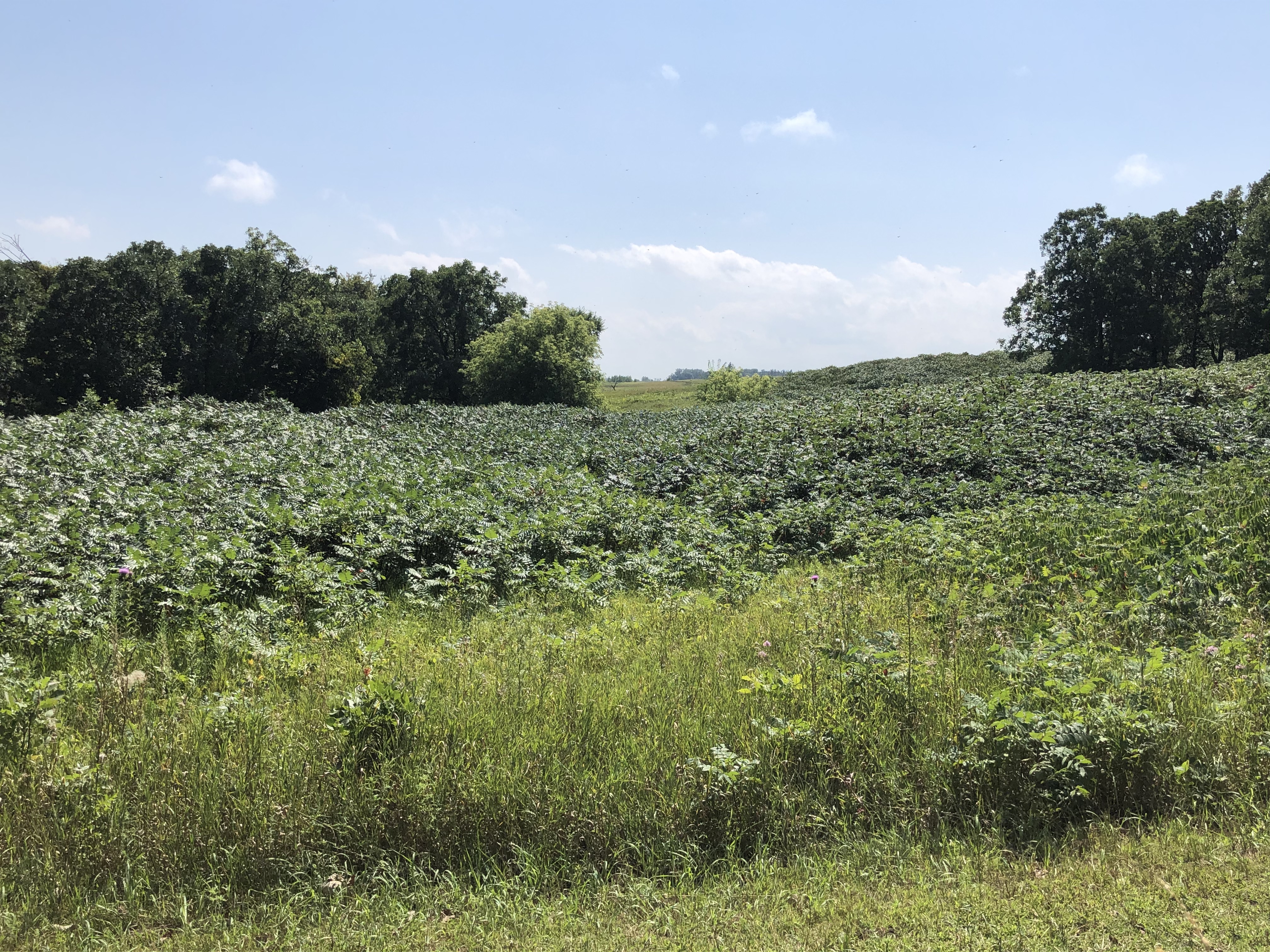
The parking for the Hiking Club Trail is just past the visitor center near the picnic area. I changed into my hiking boots and found the trailhead just across the road. The grass of the trail was still wet and the skies still filled with gray clouds. The colors of the trail were intensified by the moisture. The tall prairie grasses were tinged by the seed heads turning a deep reddish-purple. The effect over the vast section of land was magnificent and I knew my camera wouldn’t truly capture the intensity of color.
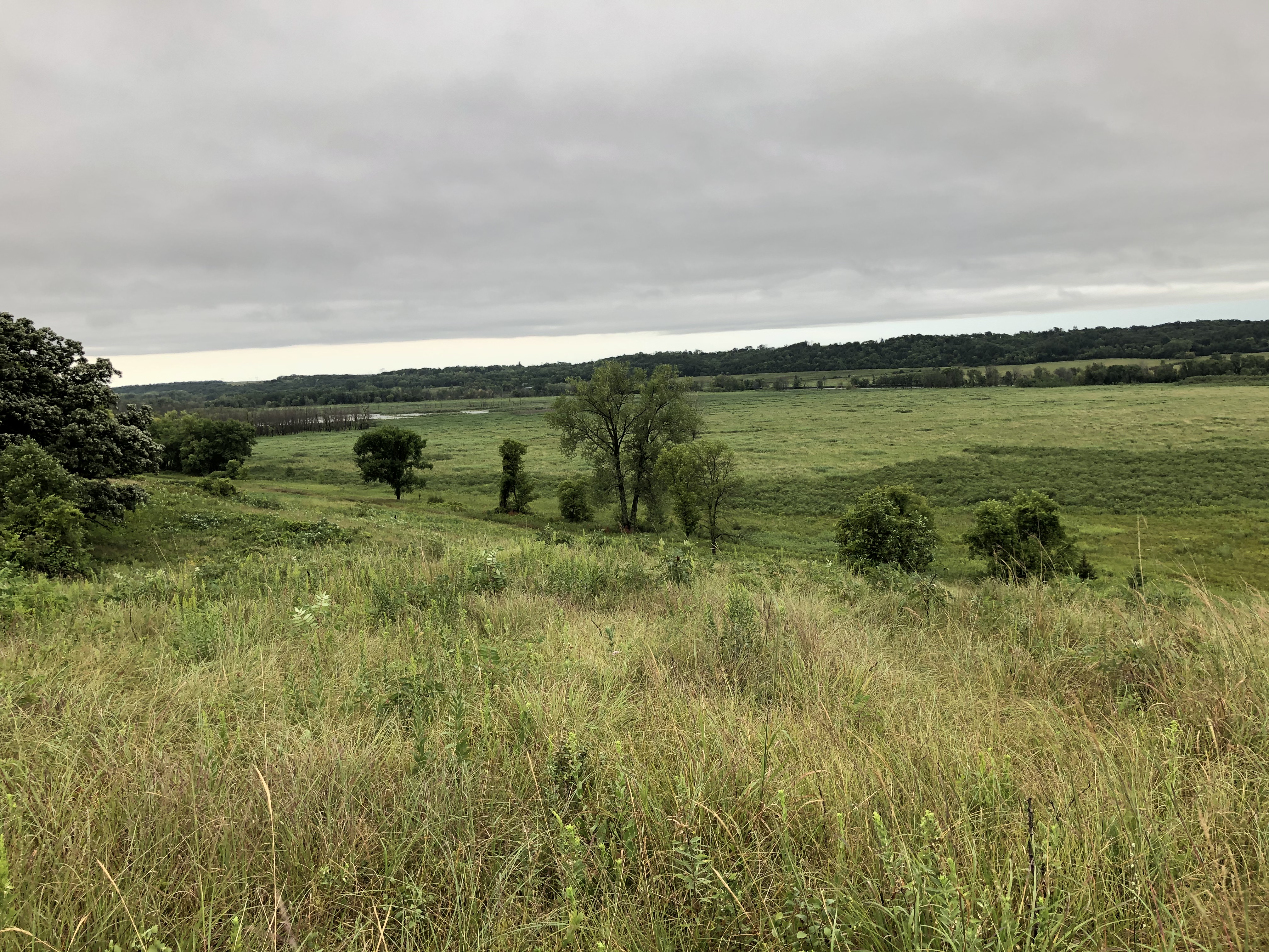
Across from where I started my hike the Upper Sioux / Yellow Medicine Agency building which is managed by the Minnesota Historical Society. Truthfully, I opted to hike around the prairie on the Valley Edge Trail and away from the building because I was feeling frustrated about the minor mentions of the first nations populations at the previous parks I’d visited and wasn’t sure I could take more this day. I wanted to see the landscape, taking it in without those thoughts clouding my mind. The view of the grasses was just too beautiful for me to be distracted.
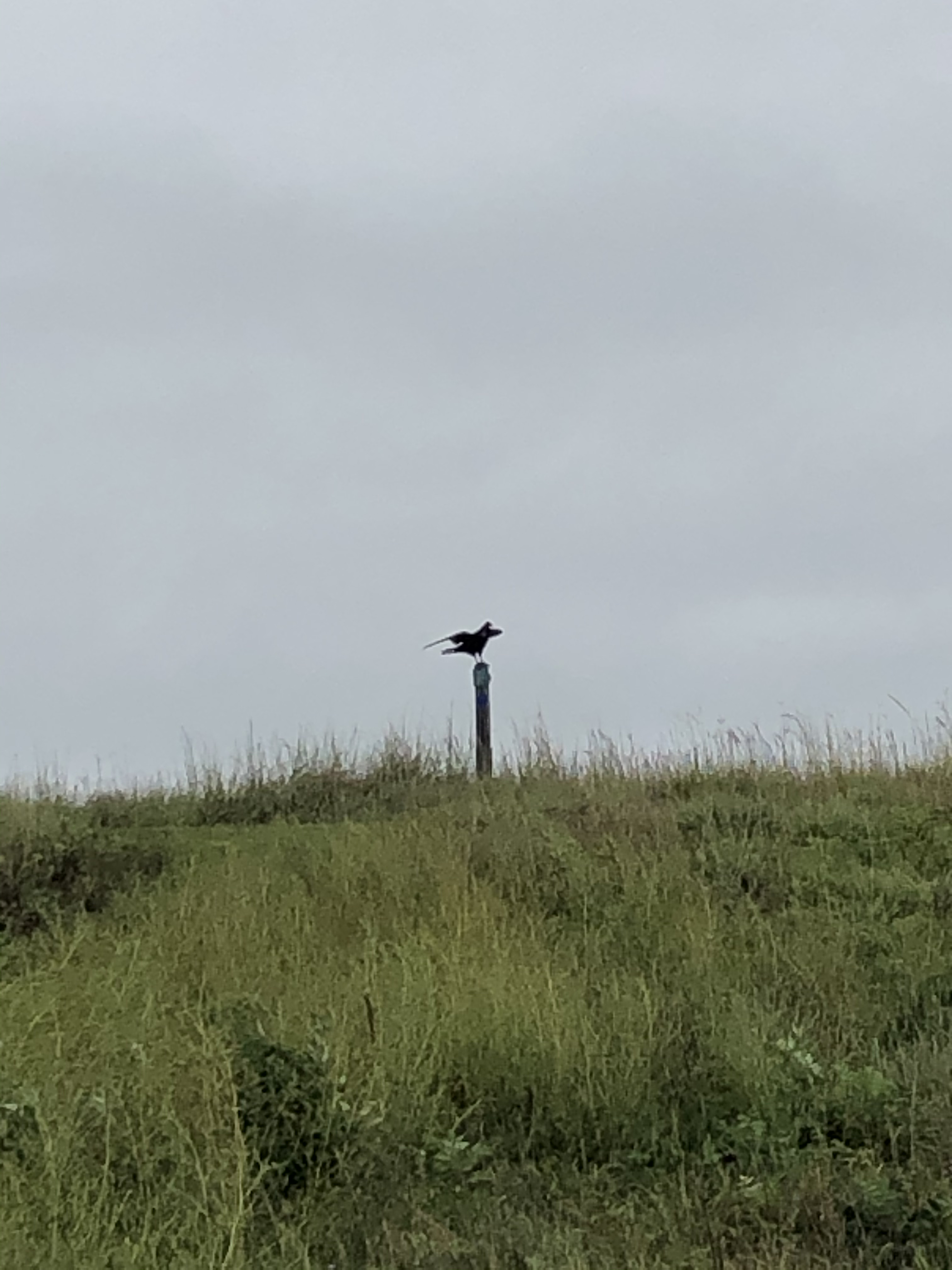
The Valley Edge trail follows the prairie for nearly a mile before connecting with the Mink Trail that sinks into a beautiful mix of bluffs and wooded slopes. At the trail junction I took a short detour to the overlook. As I approached a hawk landed on a post at the top of the overlook. Birds of prey always stop me in my tracks. They are incredible to me. Powerful hunters who are revered by many cultures. Approaching the overlook, the hawk took flight into the woods below.

Following the Mink Trail took me past the Yellow Medicine River, the Campground and back into the woods circling the bluff above on the Terrace Trail. The woods were damp, quiet and cool. A few downed trees blocked the trail, likely from the morning’s storm passing through. I kept a watchful eye for the Agency Trail that would take me up the bluff and back near the Historical Society site. An oddly placed sign had me hiking a bit further in the wrong direction than I had planned, but following my instincts, I turned around and was soon climbing up the correct trail to meet with the Valley Edge Trail again.
I again made the choice to move past the historic site and back to my car. As I changed out of my wet boots, I reflected on the beauty of this park. It’s a hidden gem that has much to offer. The summer’s challenges has put the park behind on regular maintenance so it may look like it needs some love (particularly on the Terrace Trail). Its a park I’d return to to explore more and perhaps even stay in one of the teepees offered in the campground.
Additional Resources: If you are interested in learning various perspectives of the conflicts related to the U.S.-Dakota War, I’ve shared a few in my recent posts. I will note that I don’t claim the accuracy of these, nor do I assume that they reflect the perspectives of all involved on both sides of the conflicts. I welcome perspectives on the resources I list and any new readers are willing to add via comment.
University of Minnesota Holocaust & Genocide Education

Camden State Park
#36hike of my 52 Hike Challenge
I had another of many surprises at Camden State Park. I pulled up to the Park Office to find that it was open and staffed by a very helpful park staffer. I needed ice for my cooler so I bought some along with a park patch as I checked into my campsite. This staffer insisted on climbing into the ice chest to get out the last of the bags for me. As they did, I thought how this was not what I wanted … I didn’t want to be getting that level of help. On my drive to the campground I considered another perspective. Perhaps by digging that bag out, the staff is protecting themselves from my touching the cooler and anything inside. I regretted not asking if this might be why I got the level of service I did.
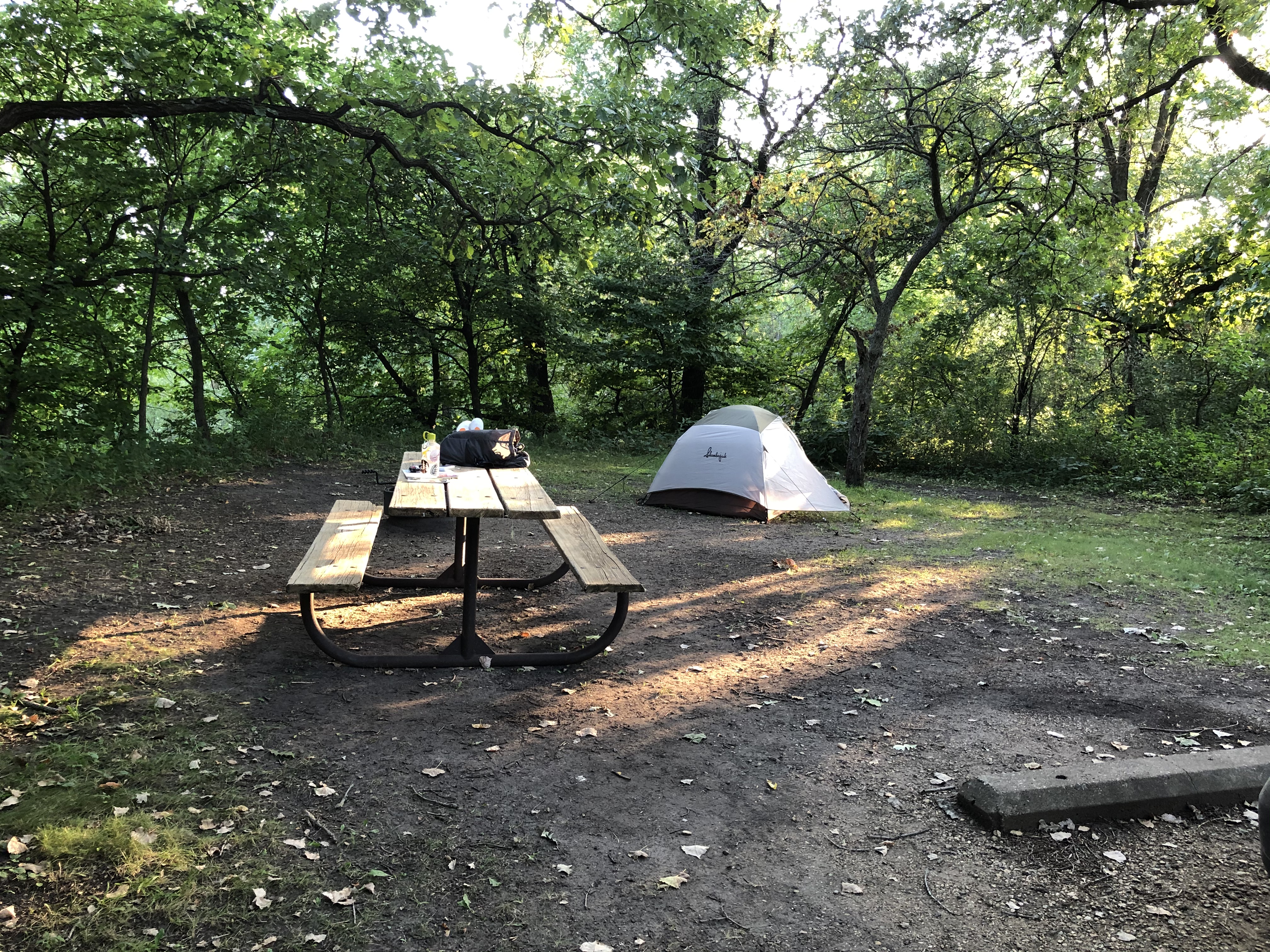
The first thing I did was to get to the campsite and set up my tent that was still wet from the condensation that I hadn’t been able to air out on my quick departure that morning. My spot was in the Upper Campground in an area that sits on the bluff above the Redwood River. The sites are nicely spaced making it easy to keep to yourself. When I’d booked this site for my trip (originally planned for June), the person helping me was a staffer from the park and had tried to get me into the site next to mine. It was booked at the time. When I rescheduled, I didn’t think to check if the recommended site had opened up. That site would have been flatter and had a nicer view. I wasn’t complaining though!


Once I was settled and had gotten a snack, I headed out to find the Hiking Club trail that is near the Lower Campground on the north end of the park. The Dakota Valley trail starts following the Redwood River. If you’re wondering where to start, the Hiking Club Trail sign has a helpful note to “start here” not far from a little waterfall. It takes a slow ascent into the woods, which reminded me of the Superior Hiking Trail with it’s path narrowing and traversing rocky, root-filled spots.


At the top of the elevation gain, the trail comes to the edge of prairie. The trail follows the edge of the prairie for close to 1.5 miles. In the late afternoon sun I was grateful for the shady spots and took many breaks for water. My stops included taking time to watch the near army of dragonflies darting over the tall prairie grass. There looked to be hundreds of them, if not thousands. It was mind boggling how many hovered and darted everywhere. I wanted to get a photo or video of them, but after several attempts with my phone, I gave up. This would be a moment that would have to be a memory that I hold in my mind.
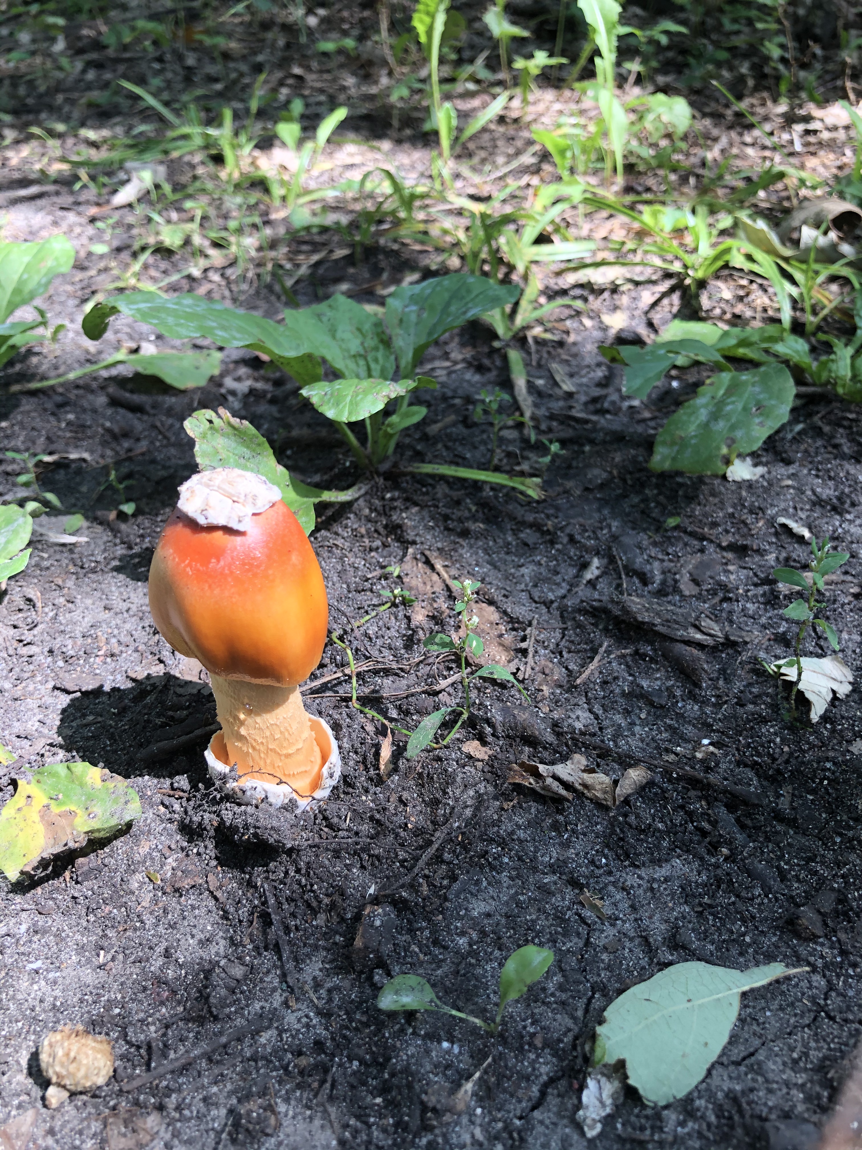


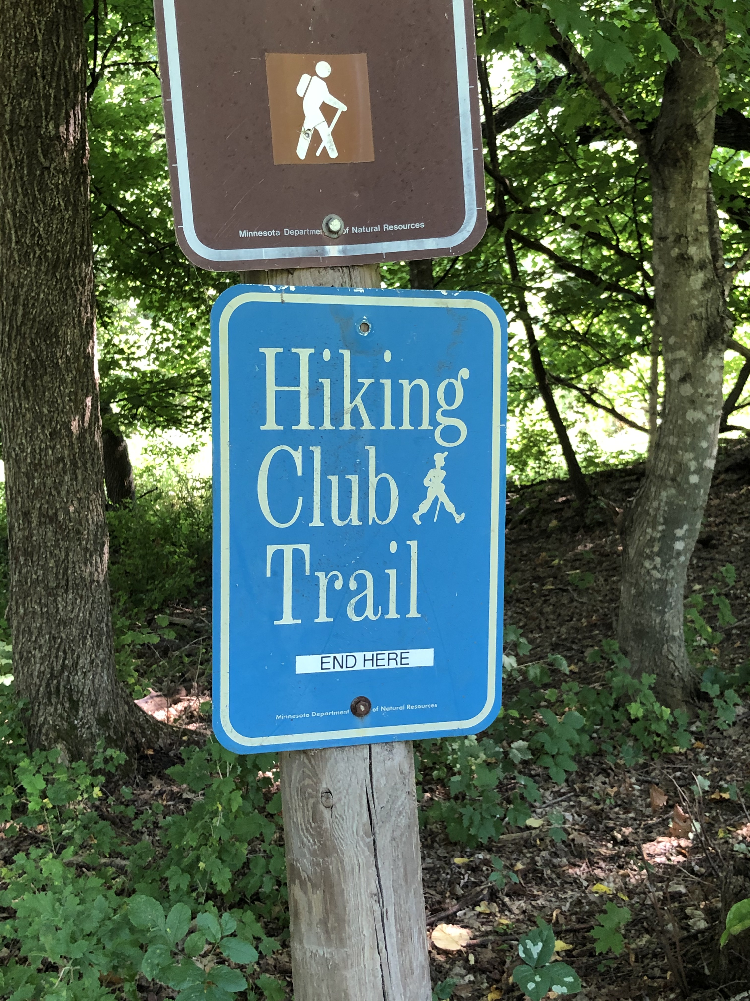
The end of the trail dropped back down near the North Picnic area and swimming beach. I happened on a garter snake taking in the late afternoon sun that was breaking through the trees. It didn’t move as I passed and took a quick photo. The warmth must have been too important to it to move. As I neared the parking area, the final Hiking Club Trail sign told me to “end here”. Of all the parks I’ve visited, this one’s start and end signs for the HCT were something I’d not seen before. It made me smile to think of directions so clear.
The park’s beach house being one of the Conservation Corp style buildings that I have come to equate with the state’s parks. There were a few people taking advantage of the beach as I emptied the small amount of trash I’d found into one of the trash bins. I took time to drive to look at the park’s Redwood Lodge that in most years would be available for rental. It’s set right on the river and looks to be a wonderful place to take advantage of trout fishing that is available in the park.


That evening I was able to get a shower and spend time enjoying my campsite as I journaled, rested and reflected. As I was getting ready to all it a night, I learned the proximity of the campground to the railroad bed thanks to the blare of a train whistle. I made note of that in my journal as well should I ever have the chance to come back and visit the park.
Next Post Preview: I spend the day taking in more beautiful parks, coming to terms with more Dakota-U.S. War (my personal change to the order) history and finding peace with where I am on this journey.
GEAR: Merrell Women’s Siren 3 Mid Waterproof, Columbia® Women’s Arcadia II Rain Jacket, Marmot Kompressor Pack, SPOT GEN3 Satellite GPS Messenger, Dueter Dirtbag, Kula Cloth, Leki Women’s Micro Vario Cor-Tec TA trekking poles, ENO DoubleNest Hammock with Atlas Straps, Guardian Bug Net and Pro Rainfly, Slumberjack 2-person tent with footprint, Paria Thermodown 30 down quilt, REI Flash 3-Season Sleeping Pad, Thermarest Z Seat™, Z Lite™ Sleeping Pad, Thermarest Z Seat™, MSR Pocket Rocket Stove, GSI Pinnacle Dualist Cookset, MSR® IsoPro™ Fuel. Want to know more about my gear selections? Head on over to Gear & Gadgets.

Support the work of
Ruth’s Blue Marble
If you like what you’ve found here, please take a minute and share with someone you think will enjoy it too. Your shares help me know what content is valuable and help support the organizations and companies I mention or link to in my posts.
Copyright Ruth Wikoff-Jones, ruthsbluemarble.com | No Use Permitted Without Prior Permission
Do you need to update your “About Ruth” section regarding your MN State Parks progress?
>
It appears I do! Thanks for the reminder.